When a road suddenly gives way, the first responders everyone sees are firefighters and city crews. But right behind them comes another kind of hero — the construction surveyor. Their job isn’t just about staking new roads or marking corners. It’s about understanding how the ground moves, what caused it, and how fast a city can rebuild after disaster strikes.
Last week, a section of Plantside Drive in Jeffersontown, just outside Louisville, collapsed after heavy rainfall. A culvert under the road failed, and a large sinkhole swallowed part of the street. Drone footage spread quickly across news outlets and social media. For people in Indianapolis, this story hits close to home. Our city has hundreds of similar storm drains and pipes running beneath older neighborhoods. When those systems fail, it’s often the construction surveyor who helps everyone make sense of the chaos.
The Wake-Up Call for Indianapolis
Indianapolis has seen its share of flooding in the past few years. Sudden summer storms dump inches of rain in an hour, overwhelming storm drains built decades ago. When these underground systems can’t handle the load, water finds its own path — sometimes right through a roadbed.
That’s what happened in Louisville. The road collapse wasn’t random. It started with slow pipe deterioration that went unnoticed until the rain exposed it. The same could happen in any neighborhood here. For construction surveyors working, it’s a powerful reminder that their expertise isn’t just for new projects. It’s also critical when old infrastructure gives up.
Homeowners’ associations, developers, and public works departments all depend on accurate, fast surveys to diagnose the damage, map the failure, and guide the repair. Without that data, crews can waste days guessing where the voids or broken pipes really are.
What Happens When the Ground Fails
When a road collapses, time matters. Traffic must be rerouted, utilities need to be secured, and crews need data fast. The construction surveyor becomes one of the first technical experts on site.
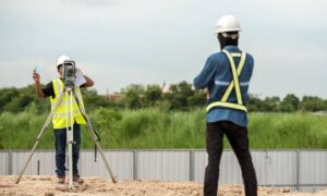
Their first task is to create order from chaos. They set up safe control points, scan the damaged area, and capture accurate surface data. Many now use drone surveying tools or UAVs to produce high-resolution images within minutes. These images help engineers measure how far the road dropped and where the soil shifted.
Next comes subsurface coordination. The surveyor teams up with engineers using ground-penetrating radar or pipe cameras to identify voids under the surface. That data becomes the basis for emergency design plans. Within 24 to 48 hours, a skilled surveyor can deliver a 3D surface model, a volume estimate for fill material, and a layout for rebuilding.
This is where precision meets urgency. A mistake of just a few inches can mean wasted materials or unsafe reconstruction. That’s why cities and contractors rely on licensed construction surveyors who can work fast and accurately even under pressure.
Lessons from Louisville’s Collapse
The Louisville collapse didn’t just break concrete — it broke confidence. Residents asked how such a failure could happen without warning. The truth is, these problems often develop slowly. Small cracks in a storm pipe expand with every heavy rain. Soil erodes, air pockets form, and eventually, the pavement loses its support.
A construction surveyor can help catch these early warning signs. Through periodic as-built surveys or drone mapping, surveyors can detect subtle ground shifts before they become sinkholes. For municipalities and HOAs, this kind of preventive surveying costs far less than emergency reconstruction.
Imagine a neighborhood that surveys its drainage ditches and culverts once a year. The surveyor logs pipe alignment, slope, and visible cracking. If a section starts to sag or settle, the data shows it immediately. Crews can repair it before the next storm hits.
That’s the value of having a protocol — not just for emergencies but for prevention.
Building an Emergency Road-Collapse Protocol

Every construction surveyor should have a plan for when the ground fails. It’s not about creating panic. It’s about being ready to act fast and safely. Here’s how it works in practice:
- Safety first. Secure the site, check utilities, and establish a safe working area. Surveyors often coordinate with emergency crews to ensure no live lines or unstable ground remain.
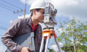
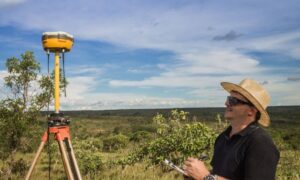
- Quick capture. Use drones, total stations, or RTK GPS to document the scene as it stands. Speed is key — rain or traffic can alter the site within hours.
- Collaborate with engineers. Share data for structural analysis, pipe inspections, and hydrologic modeling.
- Deliver fast. Within two days, the surveyor provides accurate mapping so reconstruction can begin.
These steps don’t just help fix the current failure — they create a permanent record that prevents future surprises.
Why Indy Can’t Wait
Indianapolis has miles of storm drains and culverts built long before modern surveying technology existed. Many maps are outdated or incomplete. When a road or yard collapses, crews often discover unmarked utilities or forgotten easements.
That’s why cities and property managers can’t rely on paper plans alone. They need updated surveys — accurate, digital, and accessible. Modern construction surveyors combine ground data with aerial mapping to give a complete picture of what’s below the surface.
For developers and contractors, this matters just as much. A project delayed by unexpected ground failure can cost thousands per day. Having an emergency protocol — including a trusted surveyor on call — means no one wastes time figuring out who to contact when disaster hits.
From Reaction to Prevention
The Louisville event is more than a headline; it’s a warning shot. As our region faces heavier rainfall and older infrastructure, collapses will become more common. But each event teaches something valuable: data saves time, and preparation saves money.
For every construction surveyor, this is the moment to refine your response plan — who you call, what tools you deploy, and how fast you deliver results. For property owners and municipalities, it’s time to ask: Do we have updated survey data for our critical roads and drainage areas?
Because when the ground fails, it’s not a question of if — it’s a question of how ready we are.
Take Action Before the Next Storm
If your subdivision, commercial site, or city corridor has aging drainage lines or signs of erosion, don’t wait for a collapse to happen. Schedule a consultation with a licensed construction surveyor.
A well-prepared emergency road-collapse protocol doesn’t just help you recover faster — it helps you prevent disaster in the first place.


