If you’re a builder in Indianapolis, there’s one thing you absolutely shouldn’t skip before breaking ground: a topographic survey. It might not seem like the most exciting part of your project, but it’s one of the smartest investments you can make. In fact, skipping it could cost you more time, money, and stress than you bargained for.
So let’s talk about why every builder, especially here in Indiana should make a topographic survey a top priority.
What Is a Topographic Survey?
A topographic survey maps out the natural and man-made features of a piece of land. That includes things like hills, valleys, trees, fences, utilities, buildings, and even drainage patterns. Most importantly, it shows the elevation and contours of the land.
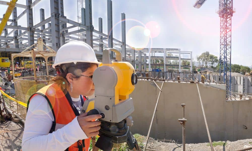
Surveyors use tools like GPS, total stations, and sometimes even drones to collect this data. It’s not just a bunch of lines and numbers—it’s a clear picture of what your land really looks like before you start digging, pouring, or building.
Why a Topographic Survey Is Critical for Construction Projects
Indiana weather and soil conditions can be unpredictable. In cities like Indianapolis, we’ve got everything from flat farmland to rolling terrain. That’s why having accurate land data before construction starts is crucial.
A topographic survey helps you:
- Plan Smarter: Know exactly where to place buildings, driveways, and utilities.
- Avoid Surprises: Skip the headaches of finding a buried pipe or hitting unexpected rock.
- Get Permits Faster: Most local authorities, including Indianapolis zoning boards, often ask for a topographic survey before issuing approvals.
- Prevent Drainage Issues: Indiana storms are no joke. Understanding slope and elevation keeps water flowing where it should.
It’s all about building with confidence, not guesswork.
Top Benefits of a Topographic Survey for Builders
Here’s how a topographic land survey directly benefits your project:

1. Better Site Planning
Knowing your site’s elevations helps architects and engineers design structures that work with the land not against it. That saves time during the build and reduces changes later.
2. Cost Control
Surprises during construction are expensive. A topographic survey helps you spot problems before they become expensive change orders or delays.
3. Improved Drainage and Grading
Water runoff is a huge issue in many Indianapolis neighborhoods. A detailed topographic survey shows where water flows and where it might pool. With that info, you can grade the site correctly the first time.
4. Avoiding Legal or Utility Disasters
No builder wants to dig into a utility line or build on a neighbor’s property. A topographic survey often includes nearby features and property boundaries to help avoid these mistakes.
5. Team Alignment
Everyone from your engineer to your excavator works off the same data. That leads to fewer misunderstandings and better teamwork on the job site.
Common Mistakes Builders Make Without a Topographic Survey
Still thinking about skipping it? Here’s what might happen:
- You misjudge the slope and end up needing unexpected retaining walls or fill dirt.
- Water pools under your foundation because the land wasn’t graded properly.
- Your plans get rejected because you didn’t provide the right elevation data to the city.
- You dig in the wrong spot, creating a safety hazard or violating local code.
- You overspend by fixing problems that a simple survey would have caught early.
All of these situations are frustrating and expensive.
How to Get a Topographic Survey
Hiring a local, licensed land surveyor is the best move. Look for someone with experience in topographic surveys specifically, not just boundary surveys. Ask them about:
- The tools they use (GPS, drone, CAD, etc.)
- How quickly they can deliver the results
- Whether their survey meets city or county requirements
- If they can combine it with a boundary or construction layout survey (to save time)
In Indianapolis, many surveyors offer bundled services tailored to builders and developers, so don’t be afraid to ask for a custom package.
Topographic Survey vs. “Just Winging It”
Building without a topographic survey is like driving through downtown Indy without a GPS or map. You might eventually get there but you’ll hit more red lights, wrong turns, and detours than you need to.
And when you’re managing budgets, timelines, and crews, every delay hurts. For the small cost of a survey, you can avoid major stress and build smarter from the ground up.
Final Thoughts:
A topographic survey isn’t just a technical document, it’s a roadmap for building right the first time. In a place like Indianapolis, where weather, zoning, and terrain can all throw curveballs, it’s your best insurance policy against costly mistakes.
So, before you pour that first footing or bring in the excavator, take a step back and ask yourself: Do I really know what’s under my feet?
If the answer is no, it’s time to call a trusted local land surveyor and get that topographic survey done. It’s not just a smart move—it’s the professional way to build.

