For homeowners, knowing exactly where your property starts and ends is more than just practical—it’s a legal safeguard. A property line survey provides accurate, reliable boundary information that can prevent disputes, support home improvement projects, and protect your investment.
Whether you’re building a fence, selling your home, or planning an addition, a property line survey ensures that everything is placed correctly—and legally. In states like Indiana, where zoning laws and setbacks vary by area, having a survey done by a licensed professional is the smart move.
What Is a Property Line Survey?
A property line survey, sometimes called a boundary survey, defines the legal limits of your land. Conducted by a licensed land surveyor, it involves field measurements, analysis of deed records, and the marking of key boundary points on your property.
These surveys are often used to:
- Establish or confirm boundary lines
- Resolve property disputes
- Comply with building codes
- Meet mortgage or title requirements
What’s Included in the Survey
A standard property line survey will typically include:
- Physical corner markers (stakes or pins)
- A survey plat or map showing your lot’s dimensions and features
- Notes on any encroachments, easements, or access rights
- A written report or legal description
This official documentation helps property owners understand the precise shape and extent of their land.
When Do Homeowners Need a Survey?
1. Before Building a Fence or Addition
Homeowners often don’t realize how valuable boundary survey services can be until they’re dealing with a fence dispute or planning an addition near the edge of their lot. A survey ensures that new structures like fences, garages, sheds, or decks are placed within your lot boundaries. Building too close to—or over—a property line can result in forced removal, fines, or legal action.
2. When Buying or Selling a Home
Buyers want assurance that they’re getting exactly what’s stated in the deed. Sellers can avoid surprises at closing by verifying boundaries early. Lenders or title companies may also require a survey as part of the mortgage process.
3. To Resolve Boundary Disputes
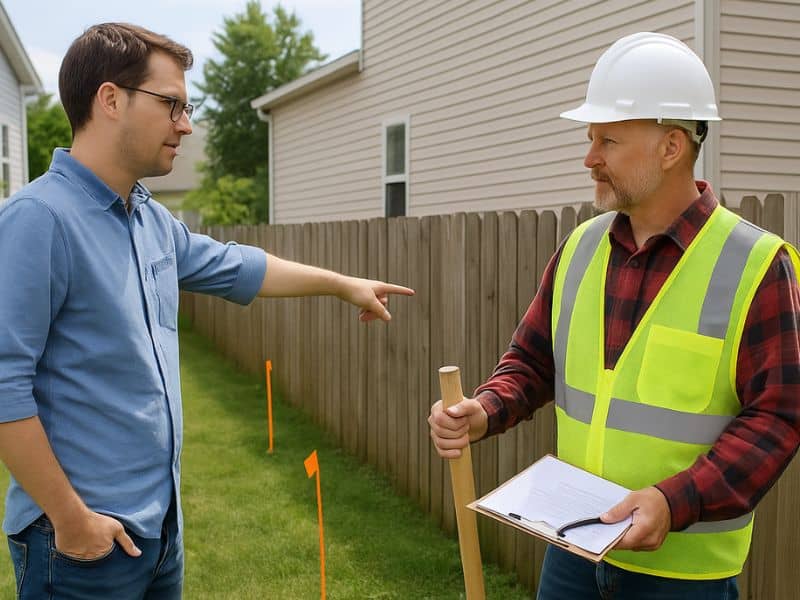
If you and your neighbor disagree about where one property ends and the other begins, a survey provides unbiased, legal clarity. It’s often the first step in resolving disagreements peacefully—or through mediation, if necessary.
Why It Matters in Indiana
Indiana homeowners face a mix of zoning rules and local building codes, which vary by city or county. In Indianapolis, for instance, you may need to follow specific setback rules, avoid utility easements, and comply with neighborhood covenants.
A licensed Indiana surveyor will be familiar with these regulations and make sure your property and structures comply.
Cost and Timeline
The cost of a property line survey depends on the size and shape of your lot, how difficult it is to access, and the availability of historical property records.
Average Cost in Indiana:
- Small lots: $500–$800
- Larger or irregular lots: $1,000–$1,500+
Timeline:
- Most surveys are completed within 2 to 5 business days, though more complex properties may take longer.
The Role of a Licensed Surveyor
Only a licensed professional land surveyor can legally conduct a property line survey. These professionals are trained to:
- Use precise measurement tools like GPS and total stations
- Interpret property records, plats, and deed descriptions
- Navigate local zoning and building regulations
Always confirm that the surveyor you hire is licensed in the state of Indiana.
Benefits of a Property Line Survey
✅ Avoid Legal Problems
Property disputes can turn costly quickly. A survey gives you a solid legal foundation for resolving boundary issues.
✅ Build With Confidence
Before starting a home project, you’ll know your plans comply with local setback and zoning rules.
✅ Support Property Value
Accurate documentation of your lot size and boundaries adds credibility and clarity during a home sale.
✅ Prevent Encroachments
A survey helps identify existing issues, like a neighbor’s fence or structure crossing onto your property—or vice versa.
Mistakes to Avoid
- Assuming fence lines are correct property lines
- Using outdated or generic plat maps
- Skipping a survey to cut costs
- Not checking for easements or setbacks before building
These shortcuts can lead to building violations, legal headaches, or even having to move a structure after construction.
How to Choose the Right Surveyor
Look for someone who:
- Is licensed in Indiana
- Has experience with residential surveys
- Provides clear communication and deliverables
- Offers fair and transparent pricing
Questions to Ask:
- What’s included in your survey package?
- Will you mark corners and provide a plat?
- How long will it take?
- Do you have experience in my county or municipality?
Final Thoughts
A property line survey is more than just a smart move—it’s often a necessary one. Whether you’re planning construction, preparing for sale, or simply want peace of mind, knowing exactly where your land begins and ends is key.
In Indiana, hiring a qualified land surveyor ensures you stay compliant, avoid conflict, and make confident decisions about your property.
FAQs
1. Can I find my property lines without a survey?
You can estimate, but only a professional survey provides legally accurate boundaries.
2. Is a survey required when buying a home?
Not always, but it’s strongly recommended and may be required by the lender.
3. Do surveys expire?
They don’t “expire,” but older surveys may be outdated due to property changes or updated legal requirements.
4. Can I use my neighbor’s survey?
No. Every property is unique, and boundary conditions may have changed.
5. How do I know if I have easements?
A surveyor will identify easements during your property line survey.


