Read Your Plat Before Getting a Property Line Survey
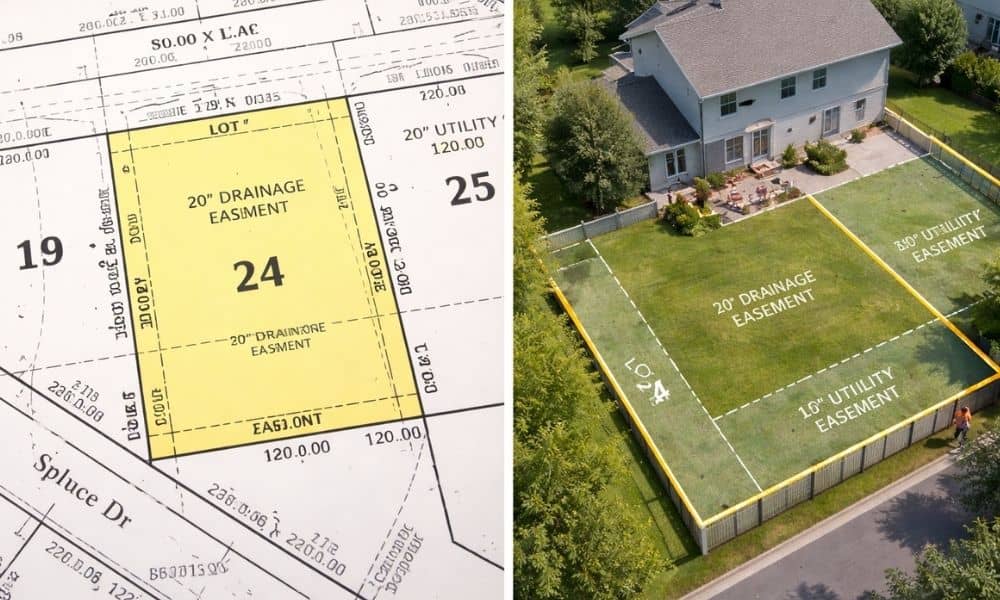
If you plan to build a fence, extend your driveway, or add onto your home in Indianapolis, you may start by looking up your property online. Soon enough, you’ll find a plat map from Marion County. At first glance, it looks clear. Lines, numbers, and labels seem to show exactly where your property sits. So […]
ALTA Land Survey Risks on Reclaimed Development Land

Indianapolis is planning a bold new idea. The South Split project could turn space above a busy highway into new land for homes, parks, and businesses. At first, it sounds simple. More land means more opportunity. However, land like this is not as easy as it looks. When cities build over highways or reshape land […]