How Important is Land Surveying in Today’s World?

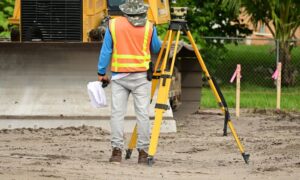
land surveying
Copyright c 123RF Stock Photos

Most of you have probably never thought about land surveying until you needed it at some point. Many of us hear about land surveying all the time but never really give it much thought. Since an investment in land and/or a home will likely be the largest investment you will ever make in your lifetime, knowing where your property lines are becomes very important indeed.

The art of land surveying was developed centuries ago. In fact, it’s one of the oldest professions in the world. The fact that it was used by man at such an early time and is still being used now shows how important surveying is to our survival.

The different uses of Land Surveying

Surveying land has many uses. Boundary surveying, for instance, allows you to know where your property corners or property lines are. This is especially helpful when disputes with a neighbor or with other people arise in terms of where your property ends.

If your family wants to divide a tract of land and transfer ownership to other family members, a boundary survey is the first step to do so. If you’re having a building constructed, it is very important that you have the land surveyed to make sure that you are not encroaching onto other peoples’ property. A mistaken building location is very expensive to fix so you might as well invest in a boundary survey to prevent this.

A topographic survey, or topo survey for short, is another important type of land surveying. A topo survey is done to locate natural and man-made features on a particular parcel of land. A topographic survey is different in that the elevation of the land is surveyed which means it can show man-made underground features, retaining walls, utility lines and etc.

Before you start any kind of construction activity, it’s important to have a topo survey done in the area so they’ll have an accurate record of the land’s existing conditions. Yes, that spot with the new mall in the neighborhood had to have a topo survey done first.

Now, a flood survey or flood determination – this is very important too. It isn’t evident just looking at a property whether you are at risk of flooding or not. And, in some cases, even looking at the flood maps doesn’t give you an accurate answer. The flood survey determines the elevation of the home and compares that to the base flood elevation.

This is the only way to be sure you’re not in a flood hazard zone. If you’ve just been told that you live in a flood-prone area, having that confirmed by a professional land surveyor would let you know how to best proceed.
When getting flood insurance, insurance companies would require an elevation certificate from you. A land surveyor would be able to assist you with this.

If a company wants to invest in another state, or if there is a national lender on a commercial project, they will likely need an ALTA Land Title Survey done before anything is constructed. An ALTA Land Title Survey is a lot like a regular boundary survey except that nationally accepted ALTA Standards are used to guide the surveying effort.

Land surveying standards vary widely from state to state and an ALTA Land Title Survey is used to cut down on this variation. Also, an ALTA Land Title Survey typically is more involved than the state standards variety. Because of this, an ALTA survey can be more anywhere from 50% to 200% more expensive than using the state standards only. If you need this type of survey, I suggest seeking an experienced land surveying company who is familiar with these additional requirements.
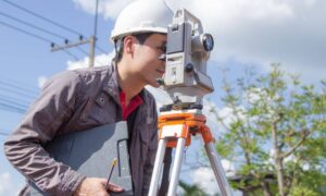
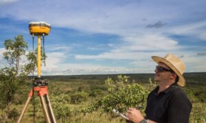
In summary, there are many uses for a land survey and for seeking the services of a land surveyor. If you’re unsure of your situation, consult ALTA Survey Indiana

author avatar
Surveyor

More Posts

Construction surveyor setting up total station to inspect road damage after winter storm
land surveying
Surveyor

Why Every Construction Surveyor Needs a Collapse Plan

When a road suddenly gives way, the first responders everyone sees are firefighters and city crews. But right behind them comes another kind of hero — the construction surveyor. Their job isn’t just about staking new roads or marking corners. It’s about understanding how the ground moves, what caused it,

Read More »
Certified surveyors measuring home elevations with equipment to prepare a flood elevation certificate for a property closing
flood damage
Surveyor

How a Flood Elevation Certificate Can Save Your Home Closing

If you are buying or selling a home, you’ve likely heard the news: the National Flood Insurance Program (NFIP) lapsed on October 1, 2025, after Congress missed its funding deadline. In just a week, the impact is already being felt across the real estate market. Closings in flood-prone neighborhoods are

Read More »
Surveyor in a hard hat using equipment during an alta title survey on land prepared for a major development project
alta survey
Surveyor

Google Data Center Halt: ALTA Title Survey Lessons

Big projects are supposed to move fast in Indianapolis, but sometimes even billion-dollar deals get stuck. That’s what happened when Google pulled its rezoning petition for a massive data center in Franklin Township. Residents filled council chambers, raising alarms about water use, stormwater, flooding, and noise. Minutes before a vote,

Read More »
Surveying team reviewing parcel data on site with property survey equipment
boundary surveying
Surveyor

How to Get Parcel Data for a Property Survey in Minutes

When you’re planning a project on your land—whether it’s adding a garage, building a fence, or developing a new site—you’ll almost always hear the term property survey. A survey shows where your property begins and ends, but it also connects to details like zoning rules, drainage, and parcel data. In

Read More »
Drone surveying with two drones flying above farmland capturing aerial mapping data
land surveying
Surveyor

Drone Surveying: Cutting Through the Hype and Concerns

If you’ve been on Reddit lately, you’ve probably seen the debates about the proposed data center in Franklin Township. People in Indianapolis are worried about water use, power demand, traffic, and even neighborhood property values. In the middle of all this, “drone surveying” keeps popping up in conversations. Some residents

Read More »
Surveyors conducting an ALTA land title survey, wearing blue helmets and orange safety vests while using surveying equipment on-site
alta survey
Surveyor

How Purdue’s Program Advances ALTA Land Title Survey Work

An alta land title survey tells lenders and property owners exactly where a property’s boundaries lie. It gives peace of mind. For many clients, it makes or breaks deals. Now, imagine if our local surveying teams could meet this need faster and easier. That’s what a new program at Purdue

Read More »

Notice: ob_end_flush(): failed to send buffer of zlib output compression (1) in /home/altasurvey/web/altasurveyindiana.com/public_html/wp-includes/functions.php on line 5471

Notice: ob_end_flush(): failed to send buffer of zlib output compression (1) in /home/altasurvey/web/altasurveyindiana.com/public_html/wp-includes/functions.php on line 5471