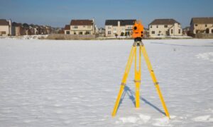
Elevation certificates are essential for ensuring that retention ponds are built to prevent flooding—especially in areas like Indianapolis, IN, where strict drainage rules apply. These ponds help protect homes and businesses by capturing rainwater and releasing it slowly during storms. But without accurate elevation data, a pond may not meet city requirements and could lead to property damage or permit delays.
A certified elevation certificate confirms that the pond’s depth, slope, and overflow levels are built correctly. It supports both design and inspection by proving everything aligns with approved plans. Whether you’re starting new construction or wrapping up a project, this certificate gives you confidence and helps avoid costly setbacks.
Retention Requirements in Indianapolis Drainage-Control Zones
The City of Indianapolis sets clear rules for how water should be managed on construction sites. Retention ponds are designed to capture runoff, hold it temporarily, and release it slowly into the city’s storm system. To do this properly, the pond must be built with specific volume and slope dimensions.
Meeting these requirements means:
- Digging the pond to a certified depth
- Making sure water doesn’t spill into unwanted areas
- Aligning the design with city-approved stormwater plans
If these elements don’t match city or FEMA expectations, permits can be delayed—or denied entirely.
Elevation Points That Affect Compliance
Elevation plays a big role in how well a retention pond performs. A few inches can make the difference between passing inspection or requiring expensive rework.
Important elevation points include:
- Pond bottom elevation — controls how much water the pond can hold
- Spillway elevation — sets the overflow limit to avoid flooding
- Emergency overflow elevation — protects nearby lots during extreme storms
These levels must align with FEMA flood maps and base flood elevation data. Getting them wrong can throw off your entire drainage plan.
Using Elevation Certificates to Support Design Accuracy
An elevation certificate verifies the as-built conditions of your retention pond. It ensures the depth, slope, and overflow levels match the plans approved by the city.
It also confirms that the pond ties in correctly with:
- Nearby drainage structures
- Connecting streets or driveways
- Surrounding lot elevations
Survey-backed certificates help show that your project meets both design and legal standards. They give city inspectors the data they need to approve your site without delay.
Preventing Flooding and Permit Delays Through Verified Elevation Data
Pond compliance is not just about paperwork—it protects homes, buildings, and infrastructure during storms. If a pond is too shallow or sits too high, it may overflow early. If the outlet is too low, water may back up onto nearby property.
Elevation certificates help prevent these problems by catching issues before they become costly. Submitting certified elevation data with your permit application also helps:
- Speed up review times
- Avoid change orders during final grading
- Build trust with the city and regulatory agencies
It’s a smart step that saves time and prevents delays.
Coordinating Surveyors and Engineers to Resolve Grade Issues
Success starts with good communication. When surveyors, designers, and contractors work together, elevation data becomes a tool for progress not a source of conflict.
Surveyors should share updated benchmarks and grade shots with:
- Civil engineers managing stormwater
- Grading crews adjusting slopes
- Inspectors reviewing final conditions
This teamwork ensures the pond is built right the first time, avoiding costly corrections or failed inspections later.
Long-Term Importance of Certified Pond Elevation Records
After construction is complete, your elevation certificate still holds value. It becomes part of the property’s long-term record and may be needed for:
- Stormwater audits
- FEMA reviews or insurance adjustments
- Future site expansion or sale
Having certified elevation data protects your investment and simplifies future work. It shows that the pond was built to code and is ready to perform when needed.
Frequently Asked Questions
1. Why does my retention pond need an elevation certificate?
It confirms that the pond is built to the required depth, slope, and overflow level based on approved designs.
2. Who prepares an elevation certificate in Indianapolis?
Only a licensed land surveyor can create and stamp this document.
3. Can I skip this step if the pond looks correct?
No. Visual inspection isn’t enough compliance must be confirmed with certified data.
4. How does this help with city approval?
It provides proof that your pond meets volume and drainage standards, reducing the chance of delays.
5. Do I need to keep the certificate after the project is done?
Yes. It supports future permitting, resale, inspections, and insurance reviews.


