How LiDAR Mapping Shows Drainage Risks Before You Build
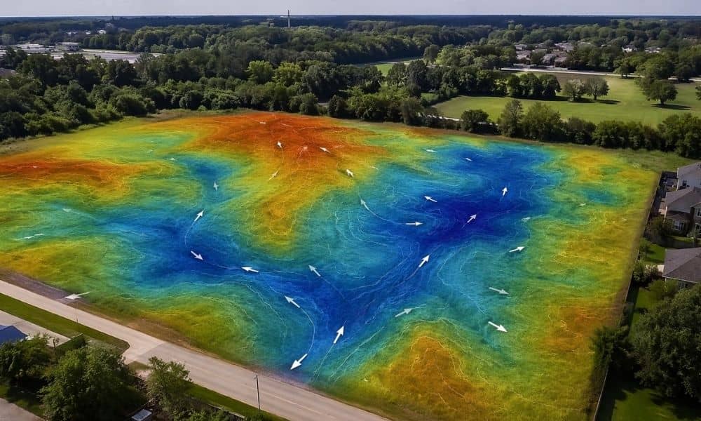
You walk a lot in Indianapolis and it looks fine. The ground feels flat. Nothing seems off. Then a hard rain comes through and water sits where you plan to build. That happens more than most people expect. Drainage problems rarely show up during a quick site visit. They show up later, when it’s already […]
Surveyors Near Me: 4 Records to Check Before You Call

You’re planning something simple. Maybe a fence. Maybe a small addition. You step outside, look at your yard, and everything seems fine at first. Then you pause. That fence line doesn’t look right. The driveway feels too close to the edge. Like most homeowners, you pull out your phone and search “surveyors near me,” hoping […]
What You’ll Get From a Boundary Survey Before You Pay
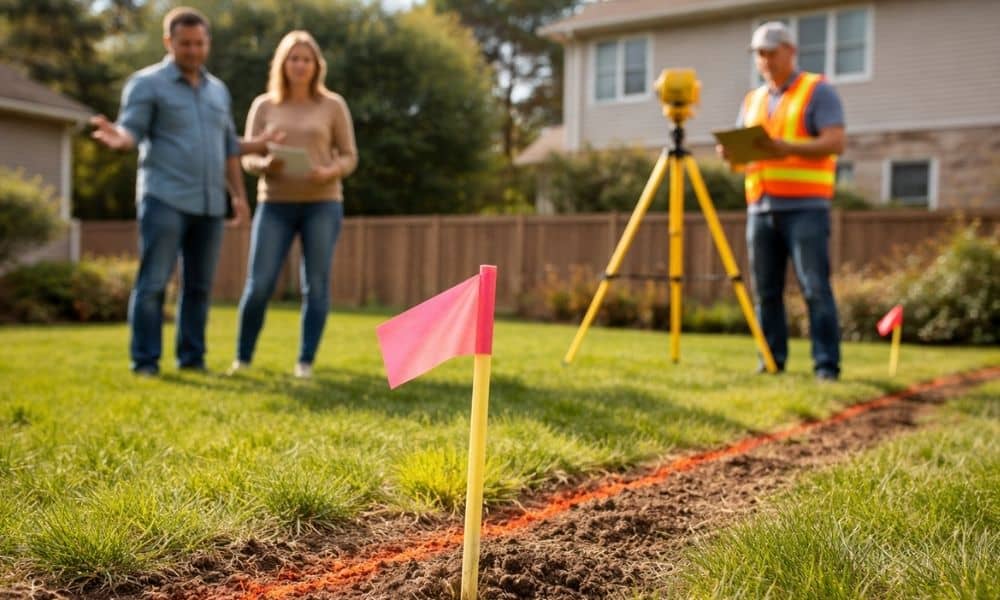
You get a quote for a boundary survey, and at first, it feels pretty simple. Someone comes out, finds your property lines, and that’s it. But then you start thinking about what you’ll actually get at the end, and things aren’t so clear anymore. Will they mark your corners? Will you get a drawing? Or […]