If you’ve been on Reddit lately, you’ve probably seen the debates about the proposed data center in Franklin Township. People in Indianapolis are worried about water use, power demand, traffic, and even neighborhood property values. In the middle of all this, “drone surveying” keeps popping up in conversations. Some residents assume drones have already mapped everything. Others believe aerial surveys prove or disprove environmental risks. The truth is somewhere in between, and understanding what drone surveying really does can help clear the air.
The Buzz Around Drone Surveying
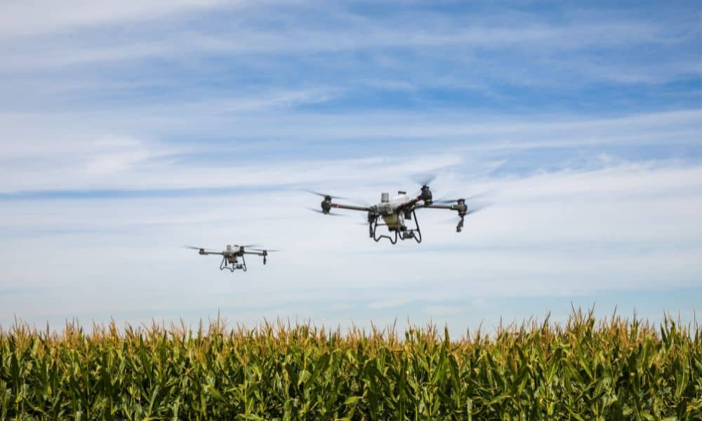
Drone surveying sounds high-tech—and it is. Surveyors use drones equipped with cameras and sensors to create detailed maps of land and structures. The technology is fast and efficient. Instead of walking acres with heavy equipment, a surveyor can fly a drone over the site and collect thousands of data points in minutes. The results include accurate photos, contour maps, and 3D models.
But here’s where the hype creeps in: a drone survey is not a one-stop answer to every community concern. It can’t tell you how much water a data center will use. It won’t predict how much electricity a substation can handle. And it won’t explain how traffic will change once construction begins. Those issues need engineers, planners, and environmental experts.
What Drone Surveying Actually Shows
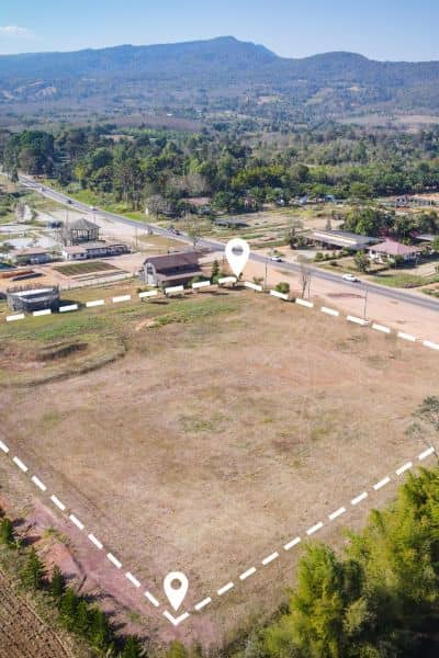
In the context of a big development like a data center, drone surveying gives us a bird’s-eye view of the land. It can reveal the slope of the terrain, existing drainage patterns, and how nearby properties connect to the site. It can also document current conditions—things like tree cover, existing roads, or visible utility corridors. This data becomes part of the larger survey package that planners and engineers use for design.
For example, if residents worry about flooding, drone imagery can help show where water flows naturally across the property. If neighbors are concerned about property lines, a drone survey can be tied into boundary data to show how close the project comes to existing homes. These insights matter, but they are still only pieces of the bigger puzzle.
What It Does Not Show
It’s important to be clear: drone surveying does not answer questions about water rights, electric grid capacity, or zoning law. It cannot measure underground pipes, it won’t capture legal easements unless tied to title research, and it cannot model noise or traffic.
On Reddit, many posts blurred these lines, suggesting that “if drones already mapped the site, all concerns should be solved.” That assumption is misleading. Drones give visual and topographic evidence, but they must be paired with other surveys and studies to guide decisions. Otherwise, the data is just an impressive image without context.
How Drone Surveys Fit Into the Bigger Process
When a developer moves forward with a large project in Indianapolis, several types of surveys and studies come into play. An ALTA/NSPS land title survey defines boundaries, easements, and legal rights. A topographic survey shows elevation and slope. Utility locates and environmental studies cover underground lines, wetlands, or floodplains. Drone surveying complements all of these by providing accurate, up-to-date visuals and surface data.
Think of it this way: a drone survey is the wide-angle photo, while the ALTA survey is the legal paperwork, and the environmental report is the risk assessment. Each one is valuable, but only together do they tell the full story.
Why Residents Should Care
For residents, the real value of drone surveying is transparency. When a project is under review, aerial maps and models can help communities see what the land looks like today and what might change tomorrow. That makes public hearings less about speculation and more about facts.
If you’re attending a meeting about a development, you can ask:
- Was a drone survey done, and when?
- How was the data verified on the ground?
- Has it been tied into boundary and elevation surveys?
Asking these questions shifts the conversation from opinion to evidence.
The Reddit Frustration Factor
Scrolling through local Reddit threads, it’s clear that people feel left out of the process. They see big numbers—like billions in incentives or millions of gallons of water—and they want proof. Unfortunately, when someone says “a drone already mapped that,” it creates more confusion than clarity. By understanding what drone surveying can and cannot do, residents gain sharper tools to challenge assumptions and demand the right documents.
It also builds trust. When surveyors explain the limits of drone data instead of overselling it, the community feels heard. That makes it easier for everyone—neighbors, developers, and city officials—to work from the same set of facts.
Moving Forward in Indianapolis
The Franklin Township debate is not the first time survey data has landed in the middle of a community fight, and it won’t be the last. As Indianapolis grows, more projects will bring the same questions: Will this development strain resources? Will it change neighborhoods? Drone surveying will continue to play a role, but it should be seen as one part of a larger due diligence process.
Residents deserve clear visuals to understand a project, and surveyors have the tools to provide them. But it’s just as important to highlight what the technology cannot decide. Drones can capture the lay of the land, yet only licensed surveyors, engineers, and regulators can translate that into legal boundaries, safety requirements, and zoning compliance.
Final Thoughts
Drone surveying in Indianapolis has become a hot topic not just among professionals but also in online communities like Reddit. That’s a good thing—it means more people are paying attention to how decisions get made. Still, separating hype from reality is essential. Drones are powerful, but they aren’t magic. They deliver valuable data that helps answer some questions, but never all of them.
So the next time you hear someone say “the drones already proved it,” remember: drone surveying is a tool, not a verdict. For communities, that means asking sharper questions. For developers and surveyors, it means using drone data responsibly, alongside boundary surveys, title work, and environmental studies. Only then can balance growth with the concerns of its residents.

