How LiDAR Mapping Shows Drainage Risks Before You Build

Aerial view of a residential lot after heavy rain showing uneven ground and areas where water has collected across the site

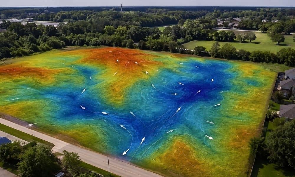
You walk a lot in Indianapolis and it looks fine. The ground feels flat. Nothing seems off. Then a hard rain comes through and water sits where you plan to build. That happens more than most people expect. Drainage problems rarely show up during a quick site visit. They show up later, when it’s already […]


Notice: ob_end_flush(): failed to send buffer of zlib output compression (1) in /home/altasurvey/web/altasurveyindiana.com/public_html/wp-includes/functions.php on line 5481

Notice: ob_end_flush(): failed to send buffer of zlib output compression (1) in /home/altasurvey/web/altasurveyindiana.com/public_html/wp-includes/functions.php on line 5481