When you’re planning a project on your land—whether it’s adding a garage, building a fence, or developing a new site—you’ll almost always hear the term property survey. A survey shows where your property begins and ends, but it also connects to details like zoning rules, drainage, and parcel data. In Indianapolis, many of these details are available online if you know where to look. Instead of waiting weeks for back-and-forth emails, you can gather a solid package of information in under 15 minutes. That means fewer delays, less stress, and a smoother start to your project.
Why Parcel Data Matters Before a Property Survey
Parcel data is more than just a map with boundary lines. It includes ownership, lot size, zoning restrictions, and even the amount of paved surface on a site. This information can make or break your timeline. For example, a homeowner who wants to expand a driveway might find out the lot already has too much impervious surface, which can affect drainage fees. A developer planning a small subdivision may discover zoning overlays that limit density.
Getting this parcel data early saves you from costly surprises. It doesn’t replace a certified survey done by a licensed professional, but it gives you a clear picture of what to expect. Think of it as doing your homework before calling in the experts.
Step One: Locate Your Parcel
The first step is pulling up the parcel itself. In Indianapolis, you can search by address or parcel number and instantly see the property lines. With a few clicks, you’ll have access to a parcel map and a property report. This report confirms your lot dimensions and ownership information. For a homeowner, this can settle basic questions like where a fence might be allowed. For contractors, it offers a verified base to discuss plans with clients.
Instead of guessing or relying on outdated plats, this step provides a reliable starting point for your property survey.
Step Two: Check Zoning Rules
Once you know where your property sits, the next step is to see how it’s zoned. Zoning codes affect what you can build and where. For instance, a residential lot might have setback requirements that prevent a garage from sitting too close to the street. Commercial properties may have restrictions on building height or parking spaces.
By checking zoning overlays, you’ll avoid designing a project that violates city codes. It also makes conversations with contractors smoother, since everyone works with the same baseline. Many homeowners are surprised to learn their property falls under multiple zoning rules. Catching that early means fewer revisions later.
Step Three: Review Impervious Surfaces
Here’s where many people get caught off guard. Indianapolis tracks impervious areas on each parcel. This includes rooftops, driveways, patios, and other hard surfaces that prevent water from soaking into the ground. Why does it matter? Because stormwater management is a big deal, and fees are tied to the amount of impervious surface.
If you’re planning to add a new driveway or patio, knowing your current impervious total helps you predict whether fees might increase. It also signals whether you’ll need to add drainage solutions. Developers and contractors can use this data to design smarter, cost-efficient site plans.
Step Four: Export Parcel Data

For those working with architects, engineers, or surveyors, exporting parcel data is a huge time-saver. You can download the parcel polygon in the correct state projection, which means it fits directly into CAD or GIS software. Instead of redrawing property lines by hand, your team works with accurate, ready-to-use data.
This step matters most for larger projects—think subdivisions, commercial buildings, or new residential developments. But even for smaller jobs, it provides clarity and precision. It’s one of the fastest ways to ensure your property survey connects seamlessly with design and construction planning.
Step Five: Cross-Check if Needed
If your project sits near a county line, or if it covers multiple parcels, it’s smart to cross-check your data against statewide resources. This is especially helpful for surveyors and engineers who manage projects. Verifying data from multiple sources ensures accuracy and avoids conflicts when property lines overlap different jurisdictions.
Step Six: Verify in the Field
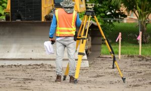
Even the best digital data benefits from a quick field check. Licensed surveyors often use GNSS receivers with real-time corrections to confirm that parcel boundaries match what’s on the ground. This step keeps everything aligned and accurate. For homeowners, it’s peace of mind. For developers, it’s insurance against costly mistakes.
Why This Process Works
The beauty of this approach is speed and clarity. In less than 15 minutes, you can assemble a mini “permit pack” that includes:
- Parcel boundaries
- Ownership details
- Zoning restrictions
- Impervious surface totals
- CAD-ready parcel data
While this quick package is helpful, it doesn’t replace the accuracy and certification that come with full property surveys. Those official surveys confirm boundaries, protect against disputes, and ensure your project moves forward without setbacks. By starting with parcel data and then moving to professional surveys, you cover both speed and reliability.
The Local Expert Advantage
At the end of the day, pulling parcel data online is about preparation. It shows you care about compliance, efficiency, and cost control. But when it’s time to certify boundaries, mark corners, or submit documents for approval, online tools can only take you so far. That’s when it helps to call on a land surveying company that knows inside and out. Their licensed team can deliver the official property survey you’ll need and guide you through local requirements with confidence.
By pairing your quick online research with the support of professionals, you get the best of both worlds: speed on the front end and accuracy when it matters most. And in today’s fast-moving development environment, that combination is priceless.
Conclusion
Parcel data may seem like a small detail, but it’s the backbone of every successful project. By learning how to gather this information yourself, you save time, reduce stress, and start every conversation with the right facts in hand. Whether you’re a homeowner planning a backyard upgrade, a contractor managing a remodel, or a developer launching something big, these 15 minutes of prep work can make all the difference.
When you’re ready to move from research to results, partner with a licensed surveyor who knows inside and out. Together, you’ll turn parcel data into a clear, accurate, and compliant property survey that supports your project from start to finish.


